February saw me out to the Ludington area for a long weekend of hiking. I headed up Friday evening after a half day of work and then went out the rest of the weekend with a hotel room outside of town. In a slow build up to my full gear, I have added a headlamp and a new pair of hiking pants for testing. I had also gotten my old trekking pants fixed (bad zipper). I found no use to the headlamp for this trip, but I like having something like this on me and I’m excited to learn more about using it. The new pants were nice and heavier than I expected. This came in handy because my old trekking pants are just a little too tight to be comfortable. I am hoping some focus on my personal health in the next few weeks will make them easier to wear, as I really enjoy them.
Nordhouse Dunes Trail
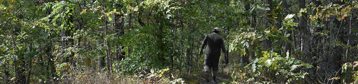
I decided to start my weekend with the longest of the three hikes I hoped to complete, Nordhouse Dunes. Declared a wilderness in 1987, there is undeveloped nature for 4 miles of Lake Michigan shore and no signs, markings, or names to guide you. 50 Trails in Michigan makes the comment that it’s sometimes hard to see as a “wilderness” but I disagree, at least when it’s covered in snow.
I started later than normal, waiting out a Winter Weather Advisory and still experiencing 14 degrees and high winds. I began the hike at the South Terminus after 6.3 miles of unpaved roads to the parking lot. Or, at least, I think they were unpaved. The ice made it difficult to determine. The North Terminus is at a Rec Area nearby that can likely avoid the national forest pass required here. Though, I couldn’t get the machine or the website to properly offer me an option to pay for the space.
I planned over 6 miles of hiking on Nordhouse, but only went 4.2 miles. The wind really got to me when I hit the ridge. I cut back on the first switch back and made a shorter hike, keeping in mind my next few days and my own safety. If I had fallen on the ridge, I would have been alone and hard to get to. I didn’t see many hikers, but there were campers, including the Troop 63 Eagle Scouts.
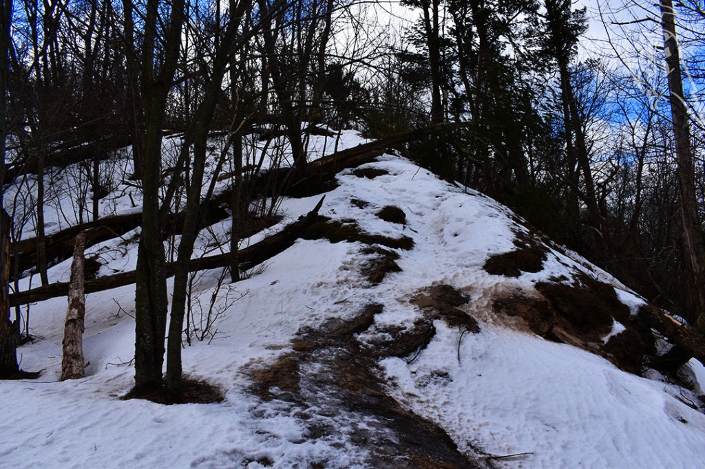
I used just my trekking poles, but easily could have easily gone for my YakTrax or Crampons. Climbing the ridges were practically sheets of ice, but were still navigable, and the snow was still deep and not packed down in places. These were just a few reasons I stuck with my poles. The cold and wind froze my water line and my neck gaiter early on, so that was also a detriment to a longer hike.
I made my way back to my hotel to warm up, eat, and relax before my Sunday excursion with the writings of Bayard Rustin and the silence only a nice vacation can give you.
Ridge and Islands Trail
My next two days were spent on trails in Ludington State Park. This is a pretty popular area, but the trails take you away from it all. The Ridge and Island Trails seemed to sit between my Saturday and Monday trails too. Nordhouse sat to the north, while the Lighthosue Trail I planned for the next day sat to the south (in the same park). The map made me wonder if the Island Trail would be traversable in the winter, but I was glad to discover it was, mostly due to boardwalks. A shelter at mile 3 also made me think I’d have a place to regroup if the weather was as bad as it had been the day before.

The app had a 5.5 mile trail but cut a majority of the Islands so I stuck more to the proposed map in the book, which was 4.8. I actually only recorded 4.4 miles though. Again, there was a a weather advisory, but this time it was for wind and it was much warmer (36). Time off Lake Michigan likely cut down on the wind’s effects and I saw a lot of hikers on the trail.
About half way, I came across a couple looking for their dog, Gertie, and I promised to keep an eye out as I climbed a particularly high dune. Thankfully, at the top, the couple gave me a thumbs up and I could glimpse the gorgeous golden retriever with them, so I hiked on. Throughout the trail, I noticed snowshoers and skiers packed the heavier traveled areas long before I arrived, which made it easier to hike. I also stuck to my normal approach to loops: do the hardest half first. I dressed the same as the day before, wanting to make sure I was prepared for any weather, and was quite warm through the day. Then, I headed back to my hotel mid-day with a stop at Lake Michigan on the way out of the park.
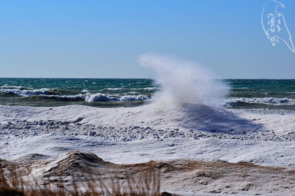
Lake Michigan
Coming into (or out of) Ludington State Park you drive along Lake Michigan for several miles through the dunes. Clearly this is a popular space to stop and get pictures, especially in the winter, so I joined the masses. Actually, I FaceTimed my mom at one point to show her the mass of frozen water and the wave activity and then assured her I’d get as good of pictures of the phenomenon as I could. But, trust me, there’s no truly capturing this sight.
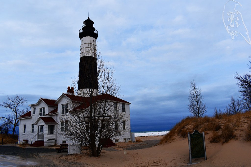
Lighthouse Trail
My final day took me back one more time to Ludington State Park before I made the trip back home to return to the everyday. Calls for a beach hike seemed unlikely due to the state of the lake at this time of year, so I was sure to have a backup plan. I determined an access road should be adequate for the trip back and that it should help cut any wind I come across from the lake. 50 Hikes in Michigan states the only time you can see the road is when you cross it, so that should indicate protection from the winds. In reality, the Lighthouse Trail is actually a combination of the Logging Trail and Lighthouse Trail, which includes open dunes.
With the detour down the access road, I logged 4.7 miles instead of the proposed 4.3 of the day. (Note: The AllTrails map starts across the river, while the 50 Hikes in Michigan map starts at Pines Campground in Ludington State Park.) I started at the park’s Warming Center, as the campground is closed and only campers can park inside anyway. I remembered to keep reminding myself there is no right or wrong way to cross open dunes. If you make it, you did it right. This also led to silencing the navigation warnings from my maps. I also made sure to take the access road back to be safe from Lake Michigan. The lake can be pretty rough to hike along in warmer weather, but once it starts to freeze it’s just dangerous. When looking at Lake Michigan in the winter, it’s tough to determine where the sand ends and the ice begins, so having an alternative route will just keep you safe.
Once I got those few hours of hiking in, I hit the road back home and was already looking forward to my March trip a few weeks out. I hadn’t hiked in 6 weeks, and I hadn’t really realized how much I had missed it (or how much my body wasn’t ready for 15 miles of hiking).
