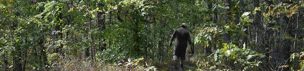
Taking into consideration that much of my time away from work this year had not been for relaxation, I decided to create a unique adventure for my long Thanksgiving weekend and get back to the trails. This included 3 hikes with the possibility of over 20 miles of hiking on my own, near the Muskegon area over the holiday. Having not tested my gear since getting a new tent at the end of October, I spent the nights in a hotel centrally located near the trails and headed out for my first trek well before sunrise on Thanksgiving morning.
44 of 52
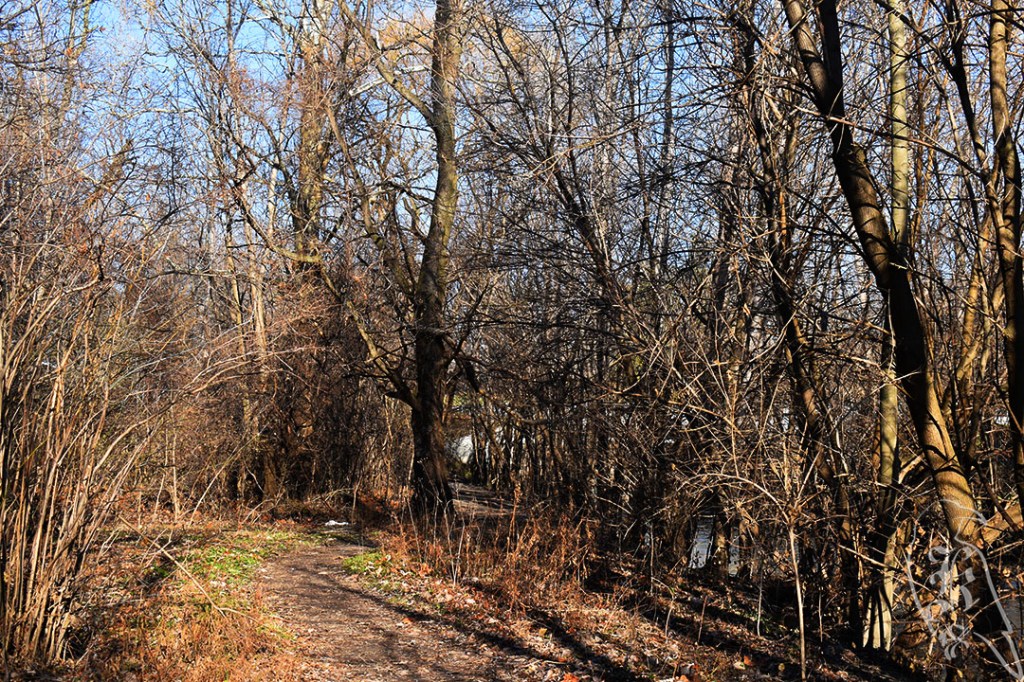
Birch Grove Connector
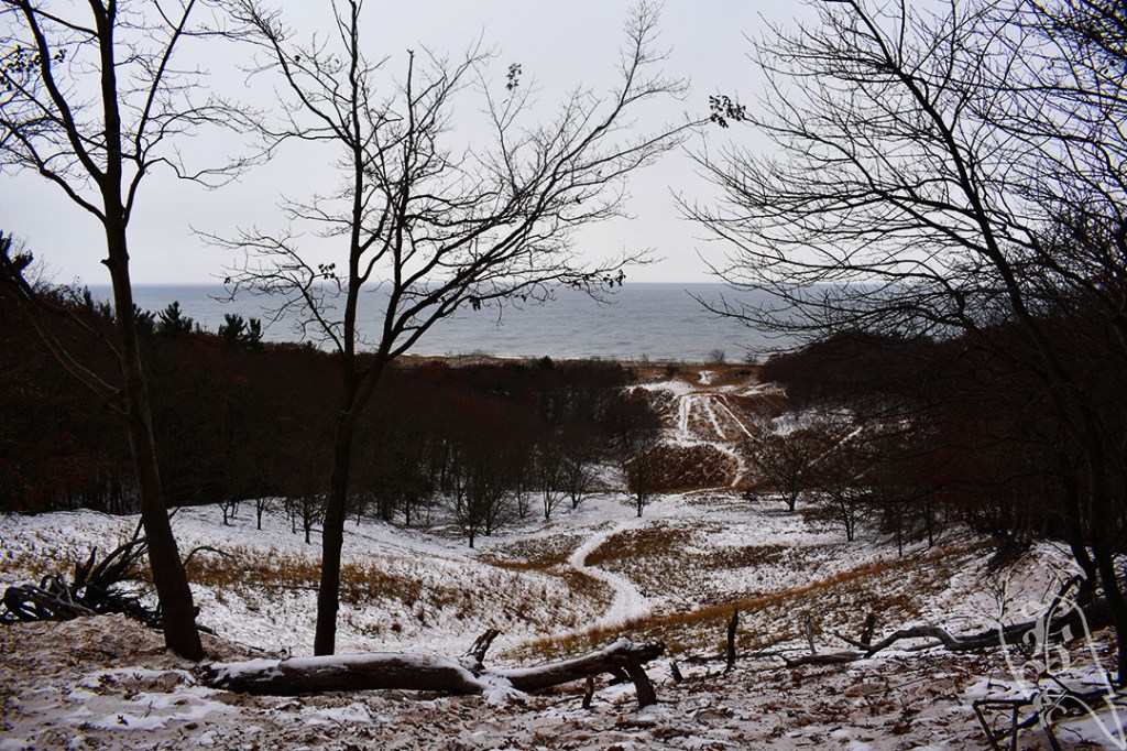
The Birch Grove Connector in Manistee National Forest and part of the North Country Trail has been on my list for awhile, but I had some issues in recent months dedicating that kind of time to hiking. AllTrails marked the hike at 7.5 miles, but 50 Hikes in Michigan stated 9.2. I went a little over 8 miles on the day.
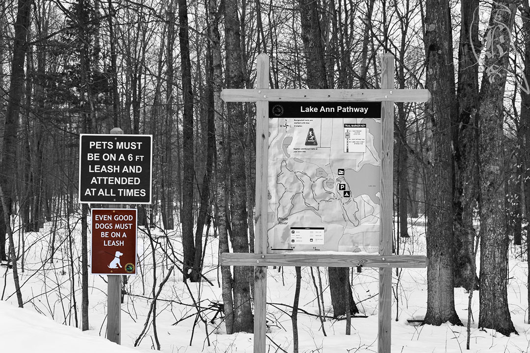
The last half mile of the drive to the trailhead is unpaved, but it was well maintained, so just be prepared for that. While there are vault toilets at the trailhead, they were closed for the Winter when I was there. Also, because the trail is located in the Manistee National Forest, a Michigan Rec passport is invalid. So, if you aren’t hiking the North Country Trail and you just drive out for a day on the connector, you’ll need to come prepared with $5 for parking. There were no sign of envelopes to pay in cash, but they did have signage that got you to their portal online on your smartphone.
It was raining and about 40 degrees when I arrived, and I was on my own for the first time in a while. As I continued to hike through the day, the rain slowly turned to snow, and wouldn’t leave for the rest of the weekend. The trail consisted of Lada Lake, a Wildflower Trail (although it was dead this late in the year), and ruins, though I’m not sure of what. AllTrails was terribly marked and the lack of physical markings (aside from the blue on the trees) isn’t helpful either.
There was also significant time on the side of a road, which was quite rough on my feet after not doing such long trails for awhile.
I have decided Blue is a stupid marker color, especially if you are marking trees. On top of the lack of posts throughout the trail, when you could find a marked tree, it was hard to discern because the color bled into the bark they marked. Finally, there seemed to be some false advertising in the 50 Hikes in Michigan book, again. Like the Haven Hill Estate, there was promise of the famous NCT school house in the book, but no such luck on the trail itself.
45 of 52
Silver Lakes
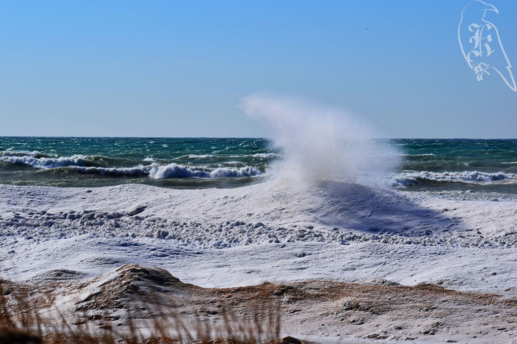
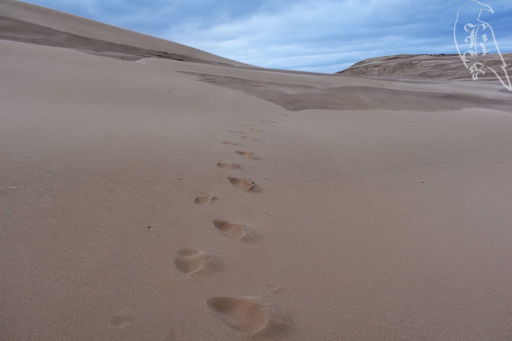
After an evening of realizing food would be hard to come by traveling on Thanksgiving, I headed out to Silver Lakes for a dune trail in the snow. Marking at the same trailhead, AllTrails marks the Silver Lakes Trail at 2.6 miles while 50 Hikes in Michigan states it to be 6 to 7 miles. The real kicker is that there is, in fact, no actual trail! This trail exists in the dunes between Silver Lake and Lake Michigan and has no true markings other than the water itself.
Have you ever seen a dead resort town? Because that is exactly what you get when you go to a lake town at the end of November in Michigan. A fresh blanket of snow had fallen overnight and the morning came with temperatures of 27 degrees with no hopes of getting much warmer. While the roads were not hard to traverse, there were definitely a few rough patches, and many of the roads in were extremely narrow.
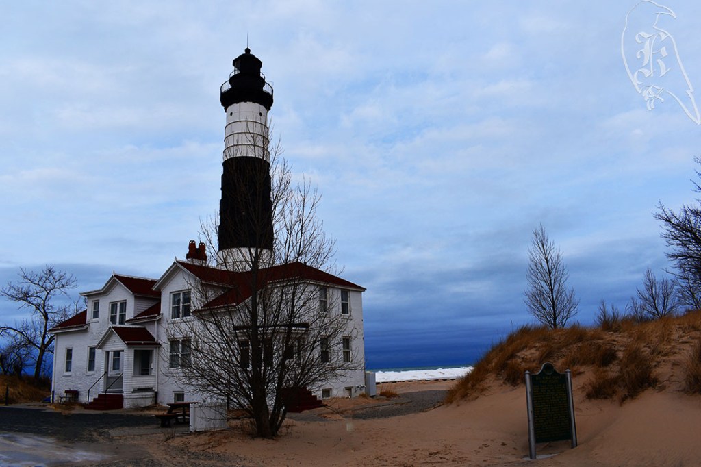
50 Hikes in Michigan marks the trail across the dunes and then down the Lake Michigan shoreline 2.4 miles to Little Sable Point Lighthouse. I decided, keeping in mind that I had another trail tomorrow and had been out for 8 miles the day before, that I would check out the lighthouse after the hike, as I am also not a fan of walking down shorelines in my hiking boots (yes, I wear my boots even on sand dunes as they protect my ankles). This did lead me to discover that accessing the lighthouse from the beach is actually probably easier.
Still, I decided there would be plenty of workout for an out and back just to Lake Michigan, so, in full winter gear, I headed out onto the 700ft dunes. I didn’t even crest the first dune before I discovered something I’d never thought of before: frozen sand! I paused, slipped on my microspikes and kept trekking. I have decided I much prefer frozen sand to the sand I fought with earlier in the year.
As I continued my hike, I quickly discovered it is quite lonely on the dunes and I learned why walking in the desert can often be described as disorienting. It’s critical to have some form of GPS on you so you don’t get lost. There is over a mile where you are incapable of seeing anything but sand. Much of Silver Lakes is home to almost no vegetation, so I learned about Ghost Forests as I walked my lonely trek across the sand. These are dead trees and vegetation that have been claimed by the dunes.
Once I reached Lake Michigan, I had to readjust some of my gear. I did some quick repair on my microspikes and readjusted my clothes. I ended up busting my hiking pants, but with extra layers and my belt, I wasn’t left cold or exposed to the elements.
46 of 52
Dune Ridge Trail
My final day consisted of the Dune Ridge Trail before driving home, and I had a snow storm looming over the lake as I trekked. AllTrails and 50 Hikes in Michigan marked the trails similarly at 4.6 and 4.2 miles respectively. Because I tend to make things harder on myself, I ended up going 5.4 miles.
Instead of microspikes, I went with the less aggressive YakTrax on this trail. And, because I hate turning around if I don’t have to, I ended up climbing up a 1000 ft dune instead of backtracking less the a quarter mile to take the right turn. Small, achievable goals and plenty of rest was the only way I made it to the top. And, I knew, my legs were going to spend the next few days hating me. This trip led to me busting another pair of pants and relying on my handy belt again. It also reminded me why I need to double down on some of my fitness goals.
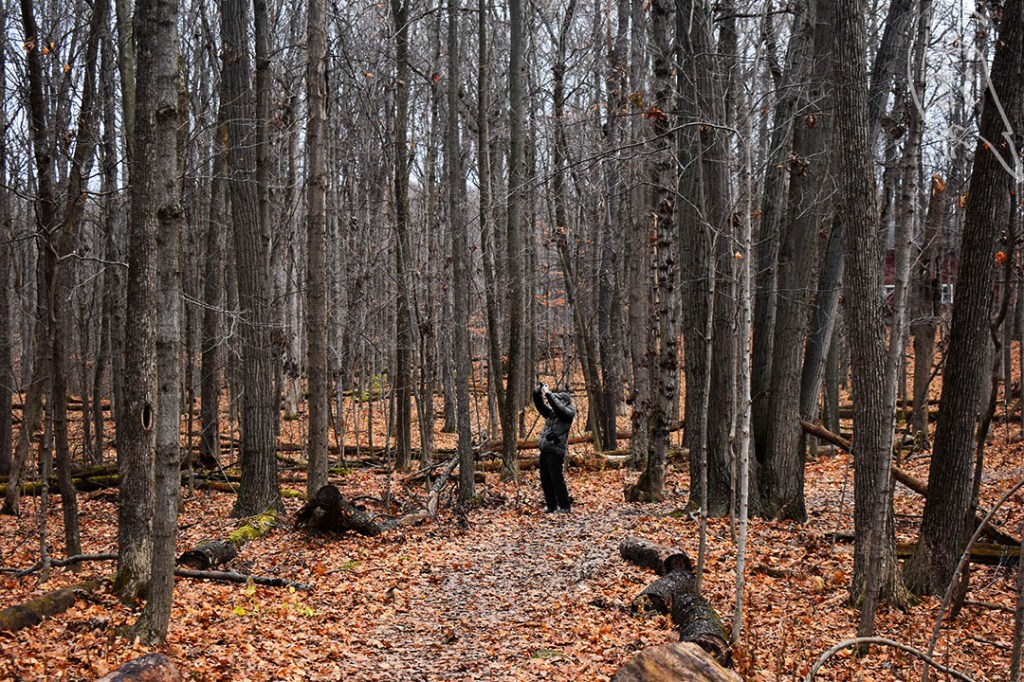
Again, the 50 Hikes in Michigan book mentioned a landmark I never saw. It stated that a blockhouse sat at the highest point in the park, but I never saw such a structure. I did come across the deserted Channel Campground, though, and I got some shots of a few deer hanging out there.
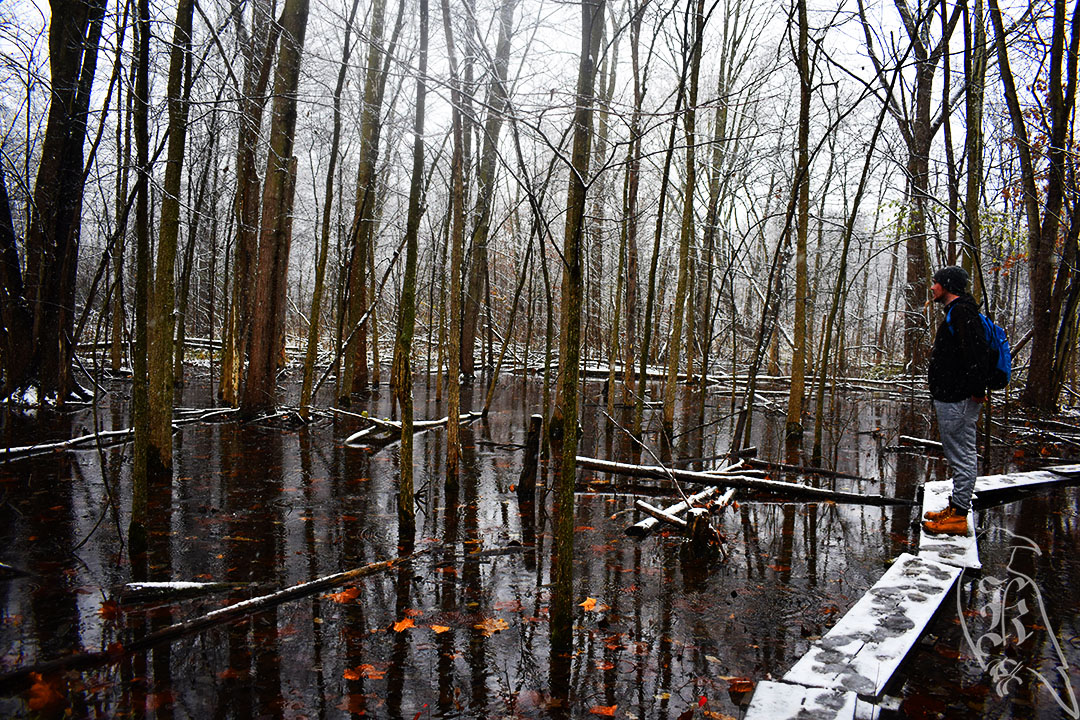
The Dune Ridge trail is actually two trails: the Ridge Trail and the Devil’s Kitchen Trail. It is largely surrounded by the waters of Lake Michigan, Lake Muskegon, and the Shipping Channel between them. Devil’s Kitchen, during warmer times, is known for the fog that rises from the swampy area (it was frozen while I was there). My suggestion would be to take the Ridge Trail first and then go through Devil’s Kitchen, as you can get the hard parts out of the way first.