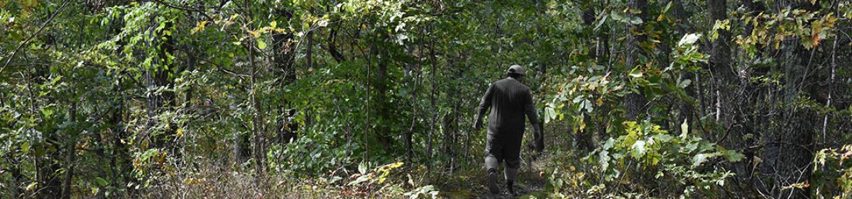
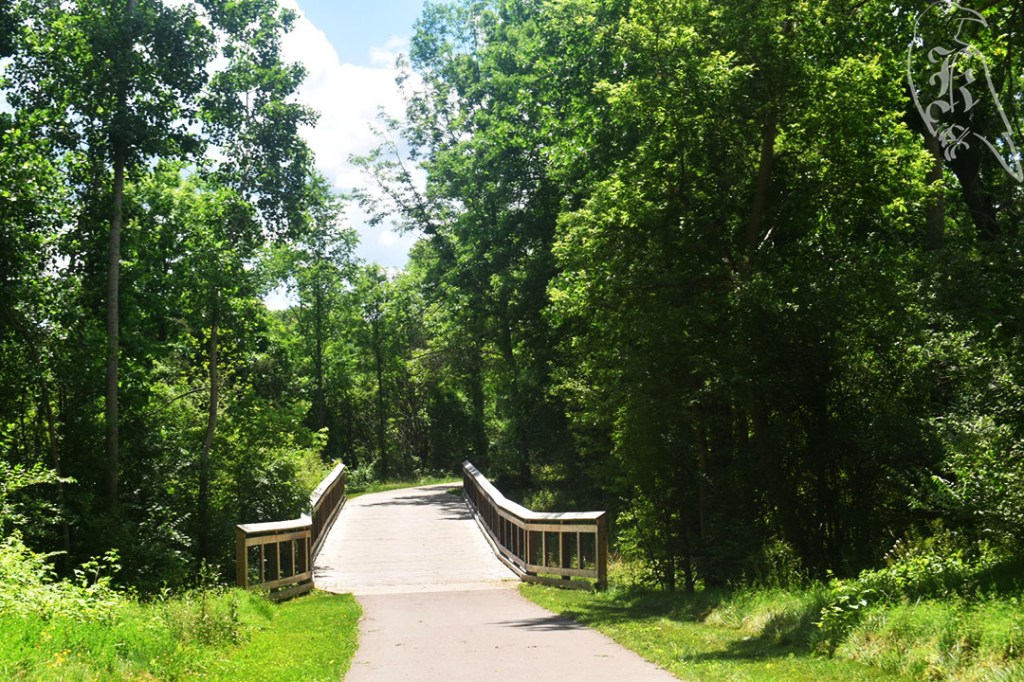
Of course, we don’t always get to plan out the weeknd before it gets here, so I took it upon myself to bookmark some “close” trails at the beginning of the Fall semester in case I couldn’t get away as I plan to every weekend. Because of this, my brother and I headed out to this 2.8 mile trek following a morning of quick errands.
It was a nice morning to take in the slightly wooded area and to soak up the sun. My brother was actually awake enough for this entire hike that our conversation took up the majority of our focus. I ended up leaving the park with only a single photo on my camera.
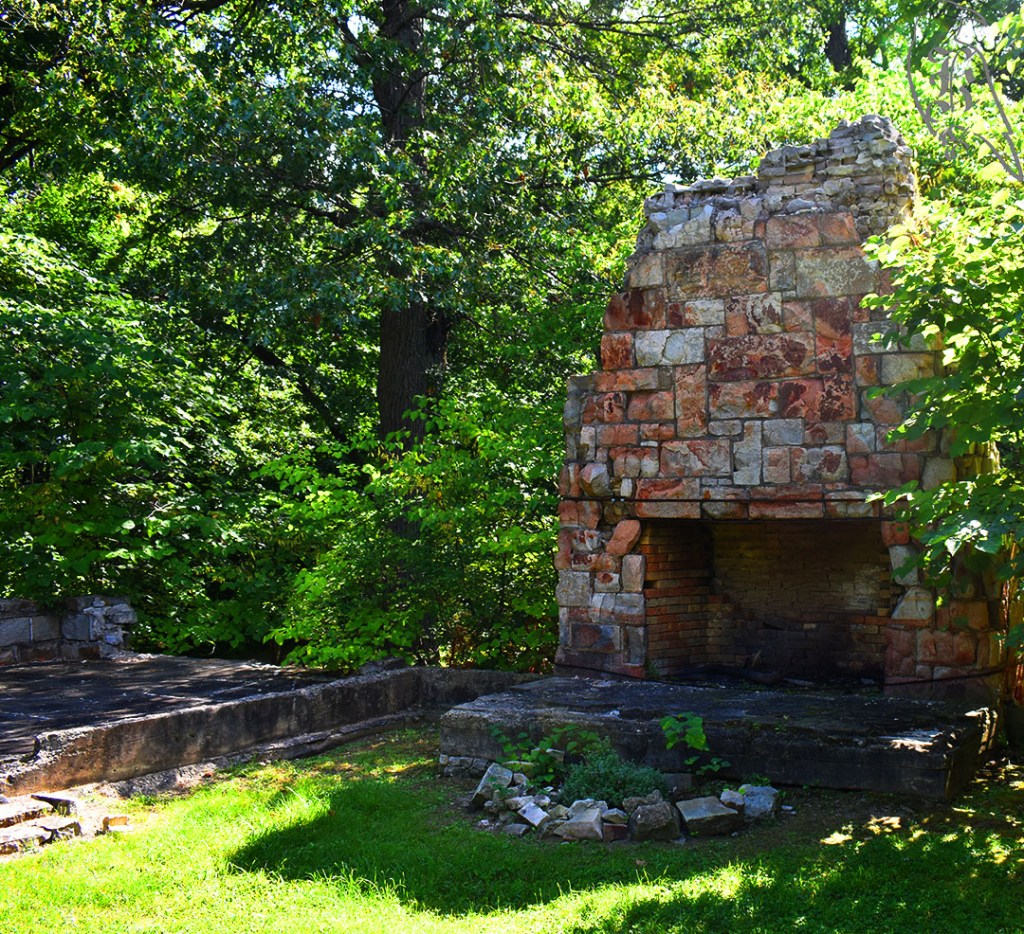
Have you ever made your life harder just to see something that you could have planned to see in an easier way? That’s what we did when it came to our excursion at Haven Hill. The original hike was meant to be approximately 3.7 miles, but I was under the impression that the Haven Hill Estate would be visible from the loop. When we discovered this assumption to be wrong, we decided to detour and climb Haven Hill to see Edsel Ford’s old estate. This actually increased our hike to almost 7 miles and increased the difficulty, due to the steep incline up the hill, to much more than my brother and I were expecting.
Was it worth it? Absolutely. The Haven Hill Estate is a piece of Michigan history that truly speaks to the man that Edsel Ford’s father, Henry Ford was, as he created the “haven” to escape the pressures of his father and his business. The Fords lived there until the late 1940s and the estate was gifted to the state for preservation of the trails that wind through the area. The mansion no longer stands, but the ruins leave an interesting picture in your head and it’s definitely worth the hike up the long, steep driveway.
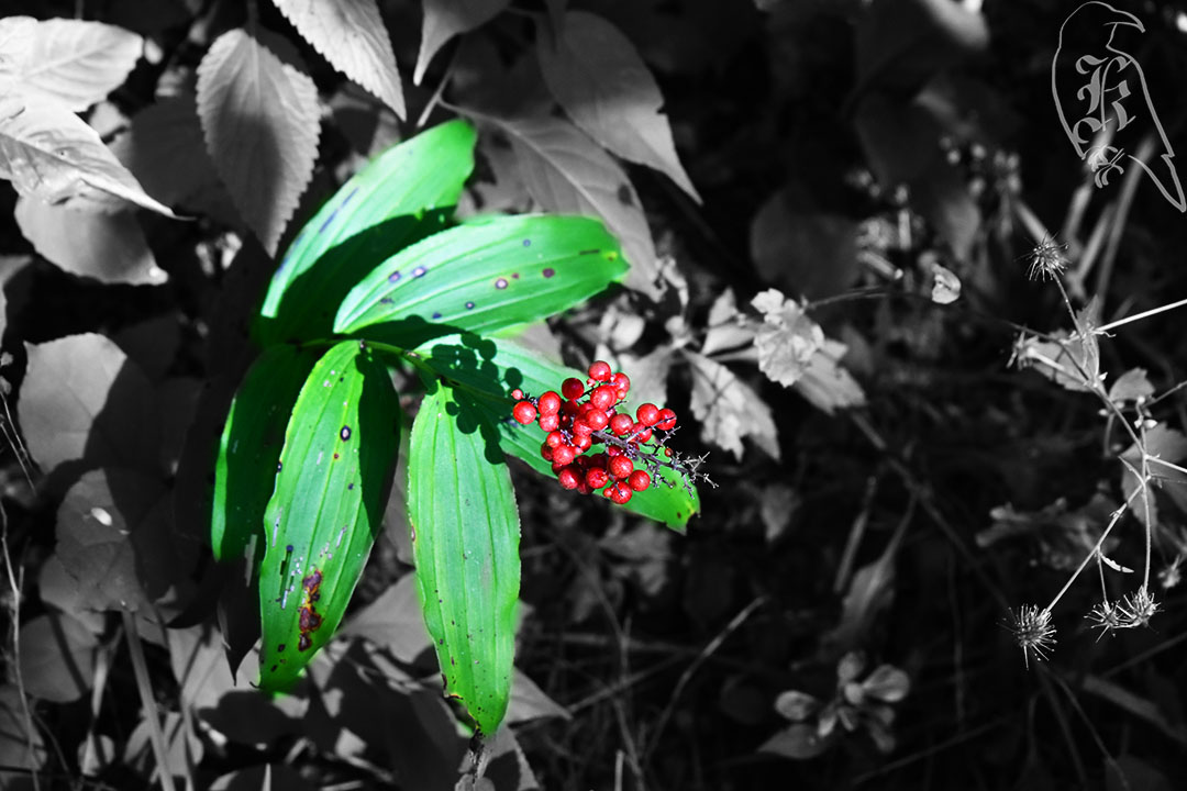
The Haven Hill Loop is also a popular area for horses, so keep an eye out for riders and the remnants of horse droppings. We went in late September and the greenery was gorgeous, even if the climb did try to destroy my legs.
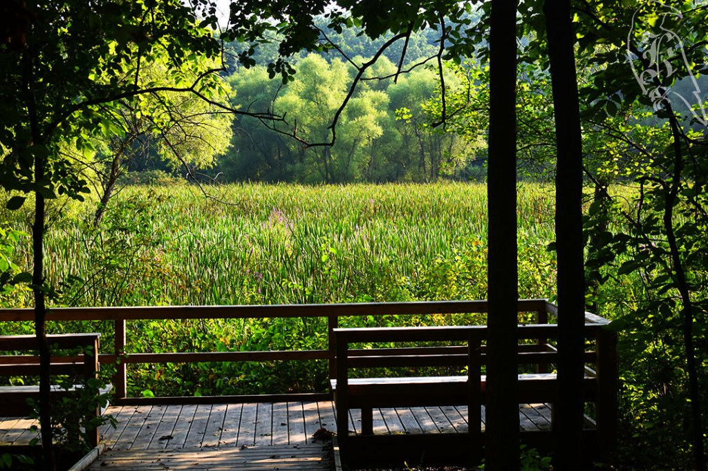
Remember that guy I was going to see after Cherry Hill? Well, yup, he’s back, and my brother is too. After meeting this student for coffee and hitting it off for 3 hours, I invited him along for the Sunday hike I had planned with my brother the next day, thinking they would get along too. (Now, I think I should make a disclaimer that “student” is just the term his title has for him, he’s a graduate student that works in my Library and is my brother’s age.) I wanted to show him some good spots as he settled into his new place, so we took him to the university’s botanical gardens trails.
Another 1.6 mile trail, the Matthaei Botanical Gardens Trails takes you through what the university’s farm lands have to offer. After getting redirected from a closed portion of the trail, we made our way to our cars and found that the gardens themselves had also been opened, so we checked out their gorgeous colors too!
Another close hike, I headed out to Cherry Hill before meeting with a Student Worker I had just hired for my new job at the Library. As a socially anxious person, it was a good way to start my morning when I didn’t know what I was getting myself into. Though, I will tell you that meeting went well and I made a new friend that day. (He might even be featured in a few of my upcoming writings.)
Still, I headed out to Cherry Hill before meeting up with him and just took in the beautiful colors and the fresh air. I really enjoyed just how lush and green everything was. The 1.6 miles weren’t challenging at all and was a great way to start my day and my weekend.
Black Pond Woods Nature Area Loop had me questioning so many things, like where people can put trails in Ann Arbor, but it was a nice little path tucked behind a neighborhood that posed more of a challenge than I expected from such a short trail. I didn’t have much time this week to find things much longer, and I wanted to get out into nature after a long week, so this was pretty perfect.
You enter the trail between two houses, which definitely threw me off, but it is marked and the trail seems pretty well traveled. You never go too far into the woods that you can’t see the houses, but it still is relatively quiet.
The path itself is just beaten down dirt but it does get pretty narrow in certain areas, so watch your step. There was also a pond you could cross and some pretty challenging hills. We had just had some bad storms, so I also had to climb over a tree down on the trail about a quarter mile (if that) into the hike.
Traver Creek Park
31 of 52
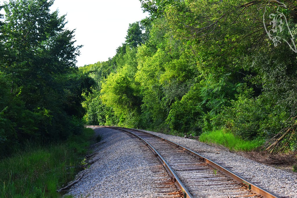
Then, just a 10-minute drive from this area, I enjoyed another short, 1 mile trek, at Traver Creek Park. I may have actually walked just as long to get to the trail as I did to actually circle the whole thing, but it was peaceful and led to some great shots.
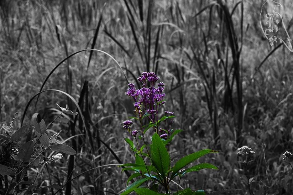
I followed a pair of guys in that were in head-to-toe bug gear (which should have told me something), but it was nice listening to their conversation about the local fora. I ended up surpassing them pretty early on, and enjoyed the colors of the flowers all around me. About half way in, you end up along train tracks, which I didn’t much care for, especially because it seemed that this may have affected the trail’s maintenance, but I also love a good set of train tracks. I was sure to capture them from the top of them on my way back to my car.
Leforge Woods Trail is just a few miles from my home and a nature preserve I pass on a regular basis, so I was pretty excited to finally check it out. The beginning of the trail is largely just a field, so the “woods” part of it threw me for a bit, but approximately the middle mile is all wooded, which led to some lovely bug bites.
I went in the mid-morning to beat the heat, so it was still relatively wet, which always gets interesting when the tall grass comes up to above your head in most places, but it was lightly trafficked and a nice bit of fresh air.
This was also my first trail where the flowers were truly in bloom and at peak color, so that took a lot of my attention. It was interesting that part of the trail that AllTrails suggested didn’t look like it had ever been traveled, so I had to forgo that way, picking safety over my self-competition of properly completing the trails in the way they are suggested.
I did make the mistake of just going in a muscle tank, shorts, and a set of sneakers, but, as you’ll see in my next few posts, I clearly haven’t learned my lesson when it comes to just doing short, local trails.
29 of 52
Parker Mill County Park Trail
Another trail I pass on a regular basis in the Parker Mill County Park trail system. A portion of the B2B in Washtenaw County, this old cider mill is usually pretty populated. It’s also mostly paved, which I kind of hate, personally. At least, I hate it for hiking. About a week later, my brother and I did the same path on our bikes, and it really is quite nice.
There were two parts of the trail that deviate from the bike paths, which were nice. One had an agrarian structure I found interesting. It’s a pavilion with a green roof so that it continues to contribute to the environment it exists in. I haven’t seen many structures like this around where I live before.
This trail also reintroduced me to a trail I had stumbled upon when I first moved to the area 4 years ago. While I didn’t go out it, it has reminded me that I would like to at some point. It’s a fully boardwalk trail through the boggy woods of the area with some really cool tree formations pretty deep in. Now that I’ve got my camera, I’m interested to spend some time out there and see what kind of shots I can get.
With my brother visiting from Taiwan and both of us having an interest in the outdoors and hiking, I decided it was time to try and give this one another shot. When I went out in January, the floating trail itself was closed, and I had never found another time, when the weather was better, to attempt it again, so we decided to make a day of it.
While I have been on floating trails before, this is the first time I’ve been on one that actually sank. If you are not sure on your feet, I would not suggest this trail for you. It’s approximately 4.3 miles total, and I’d say a good 3 miles of it is on a floating path. Once on this path, you also run into overgrown areas, which sometimes made it difficult to determine if you were staying on the marked path. Falling in was not something big on my list.
The paths were made of concrete, plastic, or dirt, so I opted to wear tennis shoes to absorb the impact instead of my usual hiking boots. I would also suggest a change of clothes for after the trail. By the time my brother and I were done, our clothes were soaked to our knees and our shoes were useless.
It was a beautiful trail though and I would definitely recommend it, especially if you are a fan of bog wildlife. We ended our early morning day by meeting the other brother for mini golf, as well. So, not only was it a good day for hiking, it was just a good day with my brothers in general.
I usually plan my hikes to make my mileage match at least the amount of hours I drive, but I decided to be a little smarter about hiking the dunes this time, so I gave a bit of leeway. 5 miles (total) on the road led to almost 5 miles hiked over sand, my least favorite terrain. Due to over a decade of biomechanical issues in my legs, I think the shifting of the sand just makes me feel more unsteady than normal, which leads to a rough day after hiking and just a general uncomfortable feeling throughout the day. But, I never have learned to back down from a challenge, and I will continue to tackle the sand dunes that are so prevalent on the Michigan shorelines. Just, maybe a bit more carefully than some of my other trails.
Homestead Trail
The majority of this 2.4 mile trek was sand or wood, which was quite rough on the legs, especially with my disdain for sand. Still, the trail was well-marked and there was no actual dune climbing on the trail, unless you chose to take some detours. Due to impending storms, I did end up cutting out both the Dunes Overlook and the Quiet Area (the most remote part of the park). While the Visitor Center spoke to the history of these beautiful dunes, I can’t speak to it though, because it was closed.
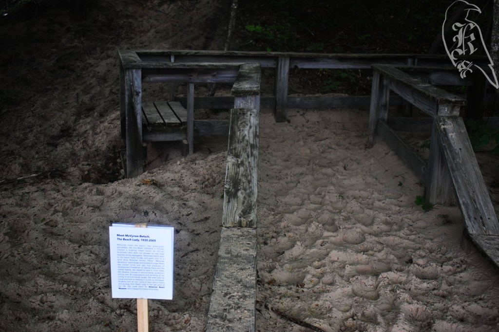
The park is named for P.J. Hoffmaster, Michigan’s first superintendent of parks and the Director of Conservation (1934-1951). He was considered the founder of Michigan’s state park system and the area is dedicated to the work he did throughout his life. I find this interesting considering the small dedication to Black outdoor activists that I came across in the latter part of my trek. Although clearly temporary, relatively recent additions, I do hope the park considers a more permanent dedication to these people. I know I certainly learned a lot.
MaVynee Betsch, The Beach Lady – An opera singer by trade, Betsch grew up on American Beach, a haven for Black Americans in the Jim Crow South. When she returned home in the 1950s, she spent the rest of her life attempting to conserve the area and educate people on the Black history of the area. While she would never see the opening, Betsch developed the idea of the American Beach Museum to carry on the legacy.
Shelton Johnson, Park Ranger – A Detroit native of Black and Indigenous backgrounds, Johnson has worked for the National Park Service for almost 30 years, educating people on the diverse history of the outdoors. Johnson wrote Gloryland in 2009 to tell a fictional tail of a Buffalo Soldier.
Rue Mapp, Outdoor Afro – Rue Mapp founded and is the CEO of the non-profit Outdoor Afro, which is a volunteer service that facilitates opportunities for Black people’s connection to nature.
Sir Lancelot Jones, Conservationist and Educator – Sir Lancelot and his brother, King Arthur, who received their father’s pineapple plantation, Totten Key, in 1929. Surviving on this piece of land taught the brother many things and, upon King Arthur’s death, Sir Lancelot sold his land to the National Park Service and dedicated the rest of his life to preserving and educating what would become Biscayne National Park.
Queen Quet, Chieftess and Art-tivist – An advocate for the Gullah/Geechee people, Nation, and continued culture, she worked to get her people officially recognized as a people in her continuous attempts to preserve their culture, heritage, and land.
Audrey Peterman, Earthwise Productions, Inc. – She is a writer and journalist that is the President and Co-founder of Earthwise Productions, Inc., which works to help provide more inclusive environments in national parks.
Betty Reid Soskin, Oldest National Park Ranger – When Richmond, CA opened the Rosie the Riveter/World War II Home Front National Historical Park, Betty joined the ranks at age 88, as a former Rosie the Riveter, wanting to make sure the diverse voices of the war movement were heard. At 99, she is the oldest national park ranger.
Jason Brown, Farmer – Brown left the NFL at 28 and became a farmer, now managing a 1,000-acre farm, First Fruits Farms, which he uses to support the community.
Dr. John Francis, The Planetwalker – Franco has walked the world for decades and has taken a vow of silence to become a better listener. He founded Planetwalk to continue advocating for environmental awareness.
Teresa Baker, Hiker and Activist – Teresa founded the In Solidarity Project to further her continued work to make a more diverse outdoor space. She has worked on several projects to help highlight the diverse history of the outdoors and to create opportunities for more diversity in the outdoors.
Livingston Trail Loop
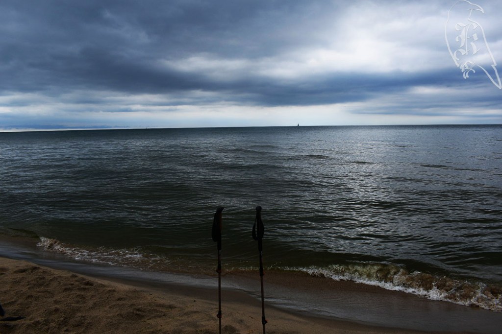
I actually just took the North Outer Loop of the Saugatuck Dunes State Park trail system instead of going in search of this offshoot, but it didn’t cut my trek by too much. The trail was not extremely well marked, so I didn’t want to chance getting lost, especially after getting stuck in the storm (that I missed in my first hike). Rain sucks, but the trail to the beach was well covered in most areas (though, the outermost part of the loop was exposed).
You have to climb a dune no matter what if you go all the way down to Lake Michigan. There’s no way to avoid that, but you also don’t have to climb down to the shore. There were a lot of people on the beach, even though you have to hike at least a mile to get there, on some challenging terrain. I truly found that interesting, and that all of these people had way more energy than I did.
A 4.3 mile walk close to home is always nice, especially when joined by my little brother, but calling this a “trail” was a little hard for me. The Matthaei Botanical Gardens are a popular greenery area part of the University of Michigan Ann Arbor campus. This particular trail is actually a biking and walking path, which takes you through the Radrick Farms areas of the gardens on a paved path.
Approximately half of this trail does not provide any shade, so, during the summer, sunscreen would be highly recommended. If you begin the trail from the botanical garden, getting to the trail is actually an unpaved experience, but taking the entrance from the Dixboro Rd. and Geddes Rd. intersection actually makes the path handicap accessible.
This trail was also our first experience with cicadas this summer, although we really only encountered them for about a mile and a half of the walk. While my brother did have one of them land on him (he’s not a big bug guy), they really weren’t as bad as some of my past experiences, but that true cicada sound was present for most of our adventure.
The Chippewa Trail is actually part of the Negwegon State Park’s trail system, which is also host to the Algonquin and Powhatan trails as well. With a planned 7 miles ahead for just this trail, I headed out relatively early to get ahead of the heat (and hopefully the bugs). This trail is a little harder to get to than most, so be aware of the 3.9 miles of unpaved, single lane road out to the trailhead. It has no winter maintenance and can be rough on the tires. Another reason I’m glad I’ve ended up with an SUV.
My Saturday morning felt like a Monday, when I got to the trail and realized I had left my sunglasses, prescription orthotics, and trail book at home. Only one of those posed any huge threat, as I use my book as a backup map and my sunglasses just make things a little darker, but I refused to let that deter my day. I headed out with the hopes of truly testing out my new water bladder, sun gloves, and copper-lined gloves (for a bad wrist) and enjoying my day in the woods.
Unfortunately, to add to my Monday-like Saturday, my bug spray didn’t seem to actually get rid of the bugs. While it was possible that the bites I noticed on my arms were from a Pride event the night before, I ended up with some nasty spots on my belt line, which were just uncomfortable by the time I got to the end of the trail. The DNR notice of nesting bald eagles also cut into my hike. These notices were well posted to help protect the animals, but it cut my trek by almost 2 miles and almost made me miss seeing Lake Huron, even though you are so close to it for the majority of the time.
The final leg of the trail was pretty marshy and felt like it should have had a boardwalk on it (or, in some spaces, that it used to have a boardwalk on it). Nothing was hard to traverse though, and it was a relatively pleasant walk. There are a few backcountry camping sites on this system, but be sure to plan that ahead of time, if you are interested. These sites require previous registration, so it can’t just be done on a whim.
Reid Lake Foot Travel Area
The Reid Lake Foot Travel Area requires a fee for parking, but this $5 can be taken care of when you arrive at the trailhead (just don’t forget to bring cash or a check). While I saw plenty of wildlife during my day, Reid Lake brought a plethora of dragonflies to my day.
Unfortunately I’d have to disagree with DuFresne’s description of the trail and its ease of use. 50 Hikes in Michigan describes the trail this way:
“Trekking is not hard at Reid Lake. The trails are well marked with blue blazes, the junctions are marked with locator maps, and the gently rolling terrain contains few climbs of any significance.”
DuFresne, 79
While it is stated that the trails will be marked blue, I do not recall seeing many of these markers around, and while there ARE locator maps, I was easily confused by them and ended up taking a wrong turn pretty early on. The terrain IS nice and rolling though. Unfortunately, and this may be due to how early in the season it is, many of the areas are extremely overgrown and, in places, it is pretty easy to lose the trail.
Due to the wrong turn, I ended up cutting this trek a bit short too (though, by less than a mile), but I think my feet were thanking me in the end, due to my lack of proper support. I did discover how generous spotty GPS can be though. Both my Fossil and FitBit tracking had me way over the mileage I had done. This trail and my issues with it reminded me to keep my expectations low, even when trails are talked up so much. But, still, a day out in the woods is better than most days, even when being eaten and a bit lost.