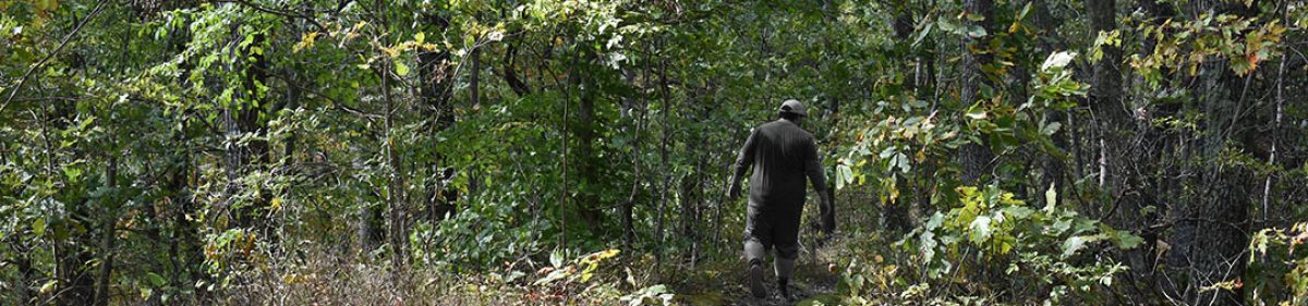
For just the second time this year, I was joined by a friend for this nice 5.8 mile trek through the woods on my year anniversary of getting back into hiking. I can say, without a doubt, this went much better than my trip this time last year, which left me contemplating why I had ever liked hiking in the first place. Of course, I reevaluated that, got better prepared, and have started on this new journey since then.
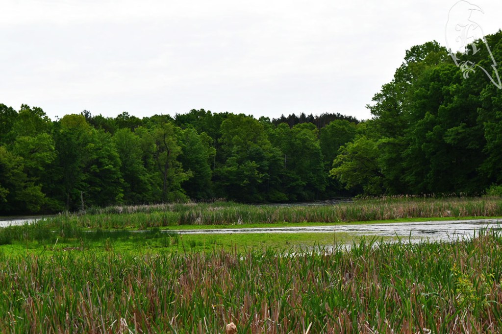
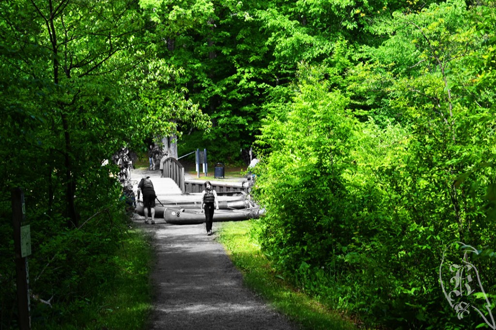
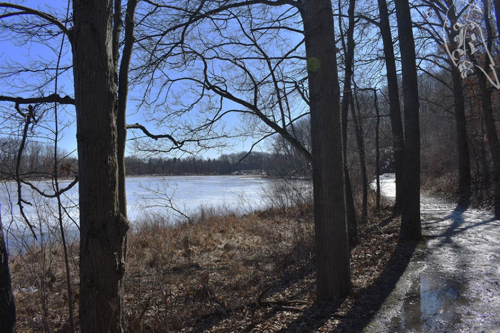
This trail system in the Proud Lake Recreation Area offered a lot of options for our day and was very hit or miss on if it was well marked or not. If it had not been for my AllTrails app, I would have been lost in the first quarter mile of the hike, but there were good maps once we got about half a mile in. It was relatively easy terrain to traverse and there were points of great beauty, including the bridge about halfway through that let us watch canoe and kayak launches and a plethora of water fun in the area.
O]]u
At about the halfway point, we did have to traverse a road for about half a mile, but both trail portions were marked way, which has not been my usual experience in those situations. The boardwalks were also continuously questionable, but it did appear that they are being fixed up throughout the trail, just be a little caution on them, as some are loose and some just sway precariously.
AllTrails marks this trail more accurately as the “Marsh Trail, River, Red, and Blue Trails Loop,” but there are so many options here to make the hike both longer and shorter. It was very well traversed, offers hike in campsites, and seems to be extremely dog friendly. We met lots of good boys on the trail! This was also a nice reintroduction to something I love after a very long month away from the trails.
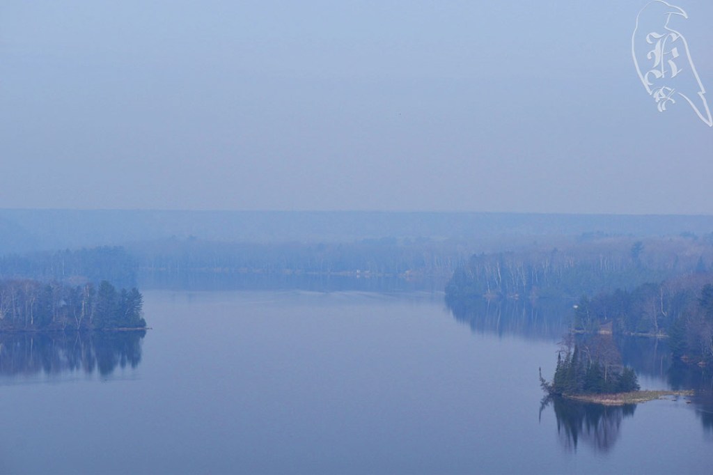
My first glimpse of the AuSable that morning was a mix of fog and smoke over the water.
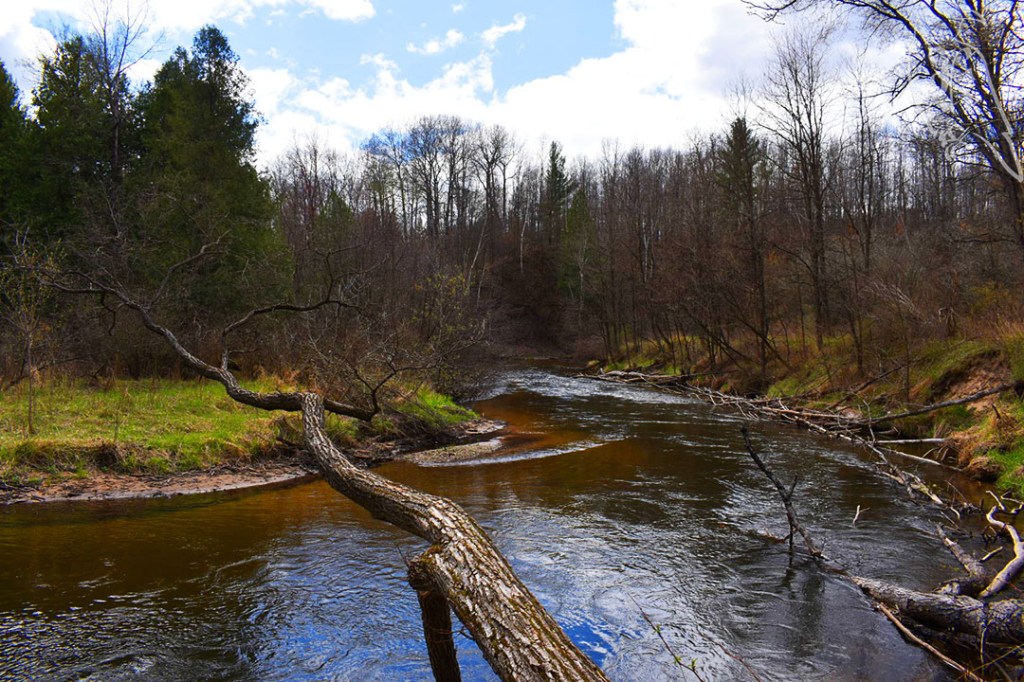
I set out this lovely Saturday to beat my personal bests in both individual hike and single day milage, which I accomplished. I hiked the entirety of the Highbanks Trail, which is a 12.7 out and back along the AuSable River between Oscoda and Iargo Springs. The “difficulty” of this trail is definitely in the length, not the trail itself, but I really appreciated the challenge and the since of accomplishment that finishing it brought me. I started and Oscoda and hiked back, but 50 Hikes in Michigan has you start in Iargo Springs and only does a portion of the trail, just past Lumberman’s Monument. I felt the book was a bit misleading, actually, as it only counts the OUT in its hike and is actually only a portion of the trail. Still, this is a good thing to remember when planning for some of my other hikes. I ran out of water with about two miles left of my hike, so it may finally be time to invest in a water bladder.
Forestry Discovery Trail
Right before I got to Lumberman’s Monument, I ended up on the Forestry Discovery Trail, which was super cool, as it taught you about the lumber industry which used to thrive in Huron National Forest and talked about the efforts that U.S. Forestry makes now to ensure the forest is growing healthy and protected. Lumberman’s Monument (my quarter-way point), near Monument Campground was hopping. Using it as a short break point, I kept myself masked due to all the people.
Lumberman’s Monument
Then, I came across a first, the remnants of a forest fire. While I only hiked through approximately half a mile of burned forest, crossing paths with the forestry workers, this was an offshoot of a bigger fire in Brittle that had consumed 200 acres by that morning. Due to this, there was constant noise on the entire trail, as Forestry worked with chainsaws and planes and helicopters kept tabs on the incident overhead. For safety, Monument Campground was closed, but all other public spots in the area remained open.
Following this encounter, I came across Canoers’ Memorial, which had a beautiful view of AuSable River, and told me about the AuSable Marathon. (I thought running marathons were rough, but an overnight 120-mile canoe race sounds insane to me.) When I finally made it to Iargo Springs for my half-way point and some lunch, I met with a state officer who filled me in a little more about the fire, assuring me the area I was in was under control. I did not hike down to the springs (a 300-step trek from the observation deck), because I was over 6 miles in and had another 6 to go, but I did see several people go on that adventure while I sat there.
Canoers’ Memorial
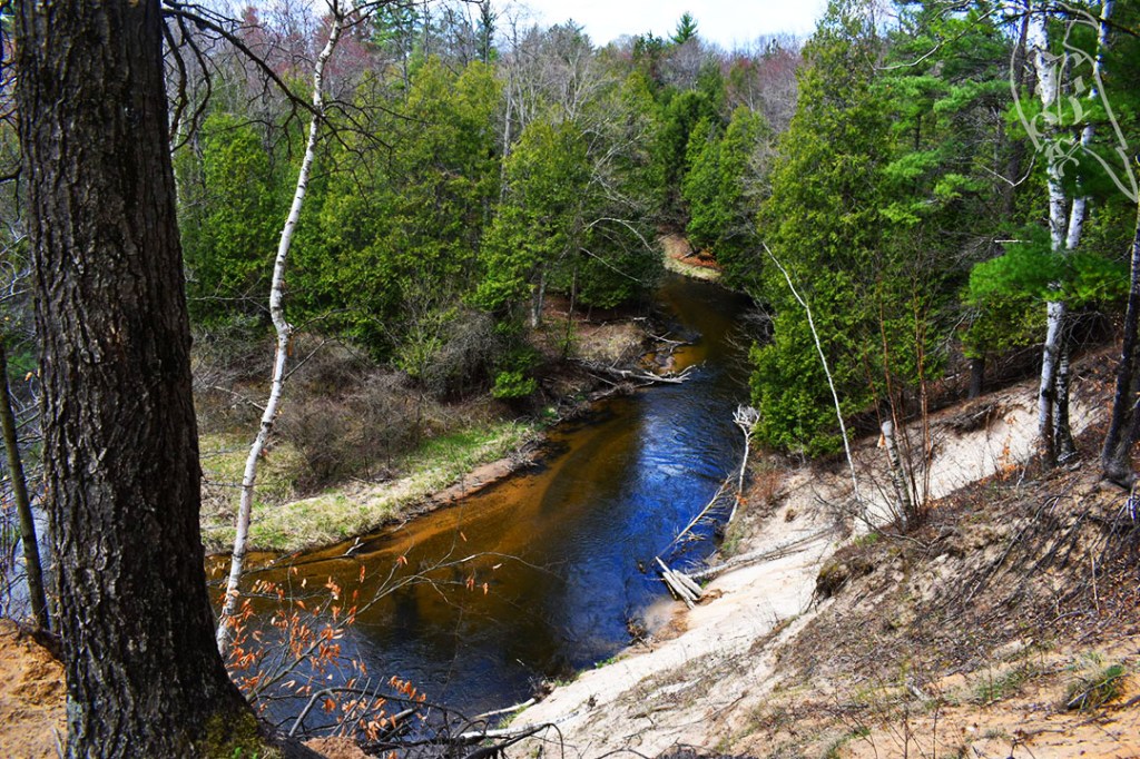
I was disappointed that you don’t get to see more of the AuSable on the trail, because you hike alongside it the entire time, but often can’t see its beauty. There are a couple of great dune overlooks that are worth climbing up for those views though. I was also surprised to learn a good portion of the trail is along power lines, so that was a little rough too, especially because the terrain around them were much more sand than the beaten path of the woods you also encounter.
For the first time this year, I did not come across a single other hiker on this trail. Pine Valleys Pathway is actually several loops that allow you to choose how you see the area. I ended up taking the Outer Loop for approximately 5.5 miles, although 50 Hikes in Michigan suggests the Inner Loop at 4.1 miles and the AllTrails app suggests the Middle Loop at 4.6 miles.
Due to trekking the Outer Loop, I experienced a bit more noise than you would likely hear on the other paths, because there is a good bit of area that parallels ORV trails, which is the only place I saw other people. Without this route, you would only cross access roads instead of running along the actual trails.
The trail itself is pretty well marked, but reading some of the posts can pose some difficulty if you are on the shorter side. Seriously, most of these map posts were hard for me to read at 5’6” but they were helpful. The terrain was low impact, with the path sporting grass, sand, and dirt. There were some areas where I felt there may be a concern for snakes due to holes in the path, but there was no posting of potential dangers and I didn’t see any of the animals. The animals I did see gave me the slip as I tried to get some good shots of a small group of deer that I chased for probably half a mile. There should be fair warning that the trail is deceptively steep. I didn’t use my trekking poles here because of the gradual rise and fall of the trail, but my legs definitely felt the work.
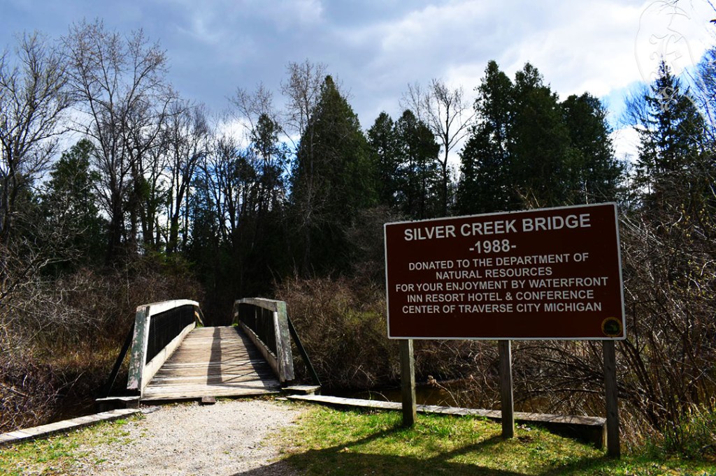
Silver Creek Pathway
I really enjoyed this 4.9 miles trek, but it was terribly marked and dangerous at times. Essentially you follow Silver Creek between Silver Creek Campground and Lincoln Bridge Campground and then follow the creek back on the other side to complete the loop, leading to some gorgeous views of the water and some challenging inclines. Unfortunately, the trail is terribly marked and there is some pretty decent overlap with ORV trails, which poses some significant danger. In the entire trek, I saw four maps, and they were very helpful, especially when you consider trying to find your way along the trail portions you may run into vehicles on.
On top of unhelpful markings, there was no service at any point on the trail, which furthered the confusion on the trail as I tried to use AllTrails to keep my way. (This is a good argument for me to pay for Pro). I also wasn’t the only one having trouble. An unclear switch back led two other hikers and I to dead end at the creek, where we had to figure out where we were. If it hadn’t been for somebody else coming our way, it would have been difficult to figure out. We all got realigned to continue our treks and went our separate ways. I hope Betsy from Grand Rapids made it out okay with her dog. When we helped her get resettled on the trail, it was not promising as she mentioned her tendency of getting lost as she went on her way.
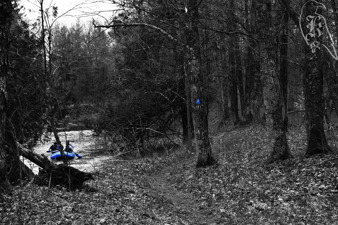
Heads up for those accessing the trail at Silver Creek Campground, there are only a few parking spots at the trailhead. I ended up walking in at the small parking area at the access road, that is for the boat ramp. I came across a canoe and a raft walking along the creek and saw kayakers launching when I left. It should also be mentioned that “creek” is a misnomer. Silver Creek is what I would consider a river, moves relatively fast, and looked deep at any point I got close to it.
Warren Woods was a peaceful 1.8 mile trek through woods that reminded me of home in West Virginia. As of April 1, no more hunting is allowed in the area, so there were a good deal of people on the trails, from early bird watchers to families and dog walkers. There were a few areas that you had to climb over relatively large trees, but nothing too difficult. It was the first day I had hiked with forecasted rain, so I kept on my rain layer, but I didn’t need it and because it was just that layer and my base layer, I felt a little overheated from the material sticking to my skin uncomfortably.
Mount Randal Trail (Warren Dunes)
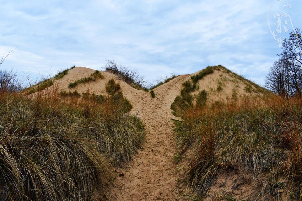
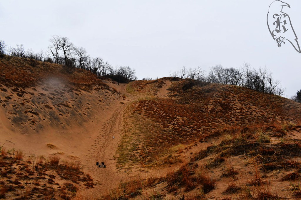
Warren Dunes is no joke and this 4.7 trek had me wanting to quit multiple times and definitely took a lot out of me. There were almost no markings on the trail, which made it difficult to follow because of the nature of hiking on sand and All Trails brought me in near the youth camping grounds instead of the main entrance. This meant that I started my hike tackling Great Warren Dune, and I was not prepared for that.
Great Warren Dune (about halfway up)
In most cases, you can bypass the dunes, but I wanted to offer a bit of a challenge to myself as well, because it helps prepare you for coming across such things on longer hikes and helps you understand better what you need to focus on when training. I took a bit of time to myself at the top of Great Warren and did a bit of a change, taking off my second layer and my gloves and gulping down some much needed water. Even though it sat at a cool 60 most of the day, the dunes were just warmer and more muggy.
Lake Michigan
A good portion of this trail is walking along Lake Michigan, which was a nice, relaxing thing to do, especially as the lake was calmer than I have ever experienced it before. Then, you cut through the woods on your way up to Mount Randall, another, smaller dune. I made it about half way up before I literally crawled to the top and I spent a good ten minutes sitting at the bottom psyching myself up for it.
Mount Randal, from my perch trying to convince myself to go up it.
If you want to do the full trail (there are 7 miles worth of them at Warren Dunes State Park), I would suggest going in at the parks main entrance, which will help you build up to the more challenging aspects of the hike, like Great Warren Dunes.
Baldtop (Grand Mere)
Even after the exhausting trek at Warren Dunes, I had another, short trek planned for the day and, although it had started raining, I figured I could knock it out quickly and get back on the road home. 1.9 miles at Grand Mere introduced me to two other dunes, which were actually easier to tackle with the layer of wet sand on top of them. I took it slow though, because I was starting to have some issues with my left thigh, which I had last week but am unsure where the pain is coming from. (I’ll be trying to determine this and probably baby the area for the next week as I prep for my next set of trails.)
Baldtop is not marked at all, so I actually missed my access to the dune originally, taking another to get back to the Lake Michigan shores. There was a suggested loop in 50 Hikes in Michigan but the terrible marking of the trails, the exhaustion from my day, and the worsening weather made me abandon the idea of trying to find it and I stuck more to the All Trails map. I found Bald Top from the Lake Michigan side and hiked back across to the woods. Then, after stripping off my soaked clothing for a quick costume change, I headed home. While I kept my camera with me and my gear held up to the rain, I was sad I didn’t get as many pictures of Baldtop, but I was sure to snap a few and try to save my camera from the rain and the sand.
After a weekend off and a rough week getting back to life, I headed out to Holly Recreation Area where I took on Wilderness Trail. I ended up going 6.3 miles on a hike that was recorded at 5.2 in 50 Hikes in Michigan but 5.7 in All Trails. All Trails had you enter at a different trailhead, which added to the distance, with the book having you pick up the trail in one of the camping areas.
It was a decently well-marked trail, although I got turned around at the ONE point that wasn’t marked well. If you head out this trail, DON’T go down the tiny, steep path just before/after the “rustic” campsite. It was a LOT of energy just to have to turn around and go back to end up where I was supposed to be. The campsite confused me as well. Marker 10 indicated crossing the campsite to Marker 11, which was true, but just confusing. To make it easier, just follow the site’s access road to the main road and cross there. You’ll find your marker easy enough, just across the road.
The trail was much more “among” things than I prefer. At one point I heard a horn for a good ten minutes. I’m assuming the good weather indicated that it was the local fire horn, not a lightning or tornado siren, which is what I’m used to. You also get pretty close to several “modern” camping locations, and I could hear the music from many of the sites on my walk.
Still, it was my first hike without snow! But, that means I was a little rough on my feet when it came to the uneven terrain. For the first time in about six months, I had some issues with some upper thigh pain in my “weak” leg (the one I had surgery on). It never hindered my ability to keep moving, but I don’t think I’d have been able to go as far as I usually do, if I had tried. Hopefully my next few treks will help my feet get my bearings a little better.
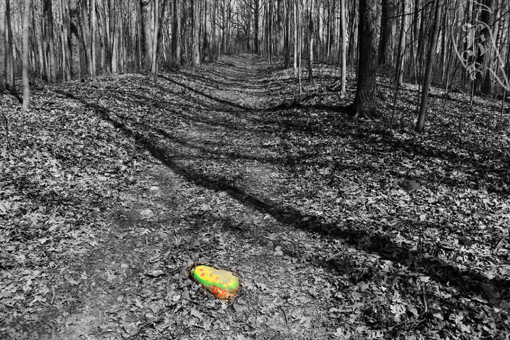
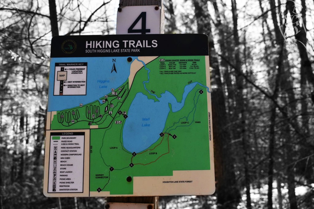
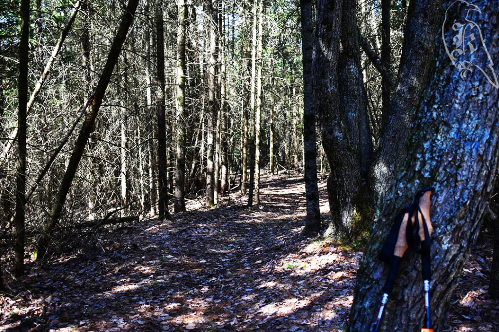
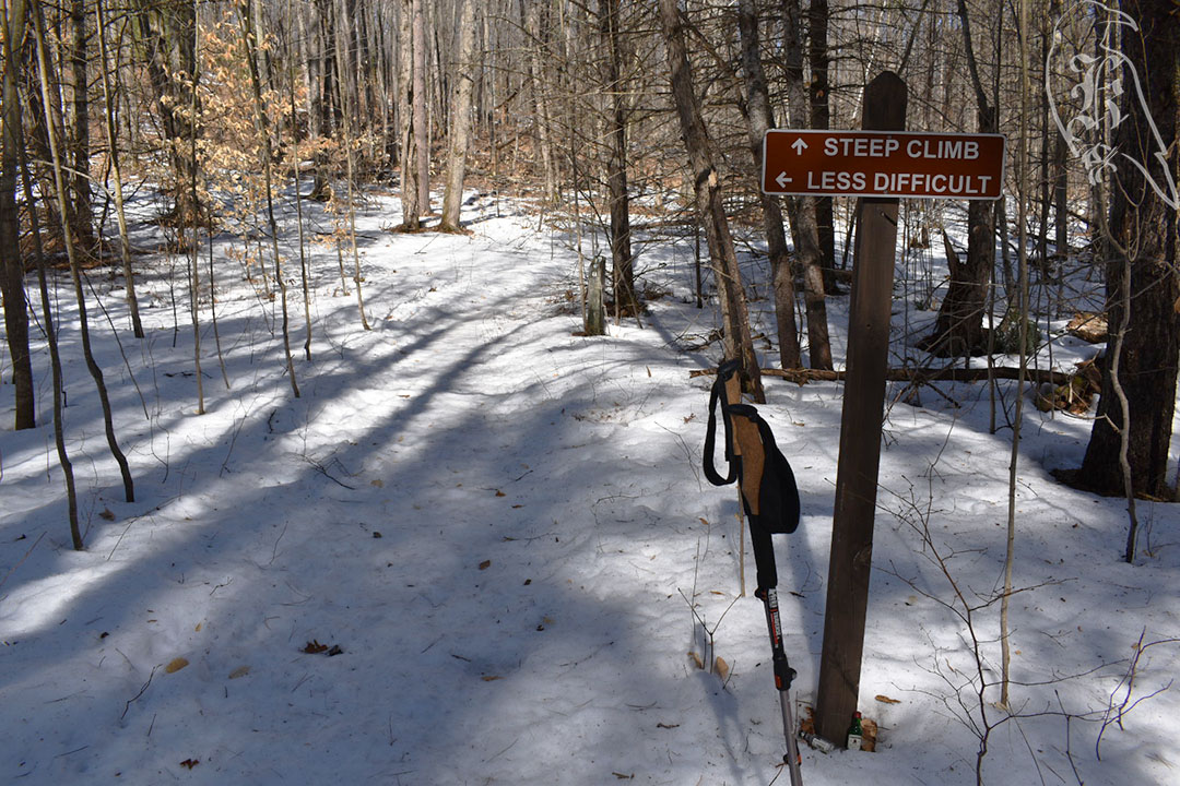
Marl Lake Loop is broken into three color-coded sections that are extremely well marked. I took the blue loop, which amounted to a recorded 5.2 miles. The farther you went in, the less traveled it clearly was. The green loop (2 miles) was a perfectly well traveled trail, with most of its trail exposed to the ground (leaves) and almost no obstructions. The red loop (3.5 miles) gave way to ice and trees down, while the blue loop (5.5 miles) gave way to snow and larger downed trees.
This was my first trail with no traction assistance on my feet, but the path had clearly experienced the strong winds that are known in Michigan from this time of year. I only saw one couple on the trail, and I’m pretty sure they were turning back, unable to challenge themselves with the obstructions. In most cases, the downed trees were easily navigable pines, but there were a few more challenging trees I had to pass. It was clear a bike had taken the trail at some point before me, and I commend that person for being able to make it through.
This set of trails also led to a new piece of gear to test, the pStyle, which is a personal urinary device that @_dragonsky__ suggested as she prepared for her thru hike of the Appalachian Trail (seriously guys, go check out her current journey). I did discover I had a bit of performance anxiety trying to use it, but I also think it’s going to be very helpful as I challenge myself to bigger and better trails and longer treks.
Lost Twin Lakes Pathway
Then, it was off to the Lost Twin Lakes Pathway, which is a 3.4 mile trek and the one-quarter completion mark for my goal this year. The trail itself was terribly marked but well trodden and relatively easy to follow. I only came across two trail markers and one of them wasn’t even great at showing you where you actually were. This trail showed the greatest amount of life I’ve seen so far this year, with sightings of woodpeckers, chipmunks, and a snake!
I did have a relatively difficult time getting home after this one though. Beware when your GPS system warns you of “unpaved roads” on your journey. I drive a small SUV and I’m from West Virginia, so unpaved roads don’t usually deter me, but these “roads” were actually ATV trails and the further I went on them the more I questioned my decisions of following my GPS. I actually got stuck twice, but, thankfully, I kept my head about me and figured it out. I always keep my ice scraper in my car year round, so when I first got stuck, I was capable of digging out my wheels and rocking the car out. The second time, I actually had to remove a tree from the trail. 7 miles of “unpaved roads” and over half an hour of questioning my life choices, I made it out to hike another day. Be careful out there guys! This is exactly why I share my location with a friend when I solo hike (which is most of the time).
I take things seriously, even when I don’t have to. When I was a teenager, I even started carrying around an “apocalypse kit” in my car, but, as I’ve gotten much more into hiking, I’ve learned I’m probably much more prepared for such survival these days. I always have my gear in my car, unless I’m double checking items for an upcoming hike, so I can just go whenever I want to. I even almost always have a change of clothes I’d be comfortable hiking in with me. Because of this, I am meticulous about checking and testing gear. I’ll slightly change my approach to things or bring a new piece of gear with me. This leads to many weird looks on pretty “easy” trails, but I’d rather be safe than sorry, used to all of my gear, and fully prepared to take care of myself if something were to happen. Considering that I spend most of my time hiking alone, I find this extremely important.
Fully understanding yourself and your limits is also essential. This falls back onto the testing gear aspect. As a kid, I was pretty danger prone, so these days I know I have some issues I have to deal with that many others my age don’t. This goes from a bad wrist to a weak ankle and a quickly tiring knee due to an old injury. This doesn’t even account for things I’ve begun to deal with in recent years, like a bad back and managing my mental health. Knowing yourself and knowing the best way to approach these issues is key to successful hikes, especially as you go bigger and longer on the trails.
When I travel, I use a wrist brace, but I know this isn’t ideal on the trail, where you might need your hands in a split second, so I have taken to testing ideas to stabilize my wrist without giving up range of movement for my hand. In this search, I’ve also learned that I prefer to wear gloves, regardless of how warm it is, on the trail. Take the time to learn these things about yourself, because you’ll be more successful in the end because of it. Hiking is both a mental and a physical game, so you need to “gear up” with everything that makes it easier for your own individual experience.
Finally, learn from others. I constantly talk about my trips to REI to gear up, but be sure to talk with the employees if you stop in stores directly. Many of these people are just as interested in the same things you are and their expertise and experience can help you pick better gear and prepare for new experiences and approaches. REI and many others also have blogs with tips and tricks, but beyond this, look for people you identify with that you can learn from, or from people whose experience you can trust.
I have recently found Justin “Trauma” Lichter, who has over 35,000 trekking miles under his belt and has written to share his experiences with others (He has even written a small, pocket Survival Guide). While I don’t identify with him on a personal level, I have found some great things to test out and have found his experiences helpful.
I more identify with someone I found as I became more serious about hiking again last year. Shilletha, or @_dragonsky__ on Twitter, started a thru hike of the Appalachian Trail just a few weeks ago and her Twitter, YouTube, Patreon, and partnerships have provided a ton of helpful information in my approach to getting more serious about my own trekking. Her gear has led me to try some things and her own experiences have encouraged me to take myself more seriously as I embrace my inner nomad more fully.
After a trip to REI this week, I tested out some new gear and some new setups for my day trekking. With a few rough weeks on microspikes, I tested Yaktrax on the slowly thawing trails. Not as sure on my feet but definitely better than destroying my microspikes. I also took a new approach to carrying gear, which is going to take getting used to, but definitely worked better. After a gear suggestion, I actually used both trekking poles, and understand why they are suggested to be used as a pair. This was allowed due to a 5L waist pack, which is great for carrying my camera (which I used to keep lashed to my arm) and for easy access to snacks and water.
With 4 miles on the Au Sable River Foot Trail, I was surprised by the extremely well marked trail and came across my first true trail obstruction this year. While it was a large tree down, it didn’t make it impossible to pass and I didn’t even have to leave the trail, thankfully. The trail was extremely flat and pretty level, with only one steep incline, which, if I had been going the “right way” I would have even had a heads up on.
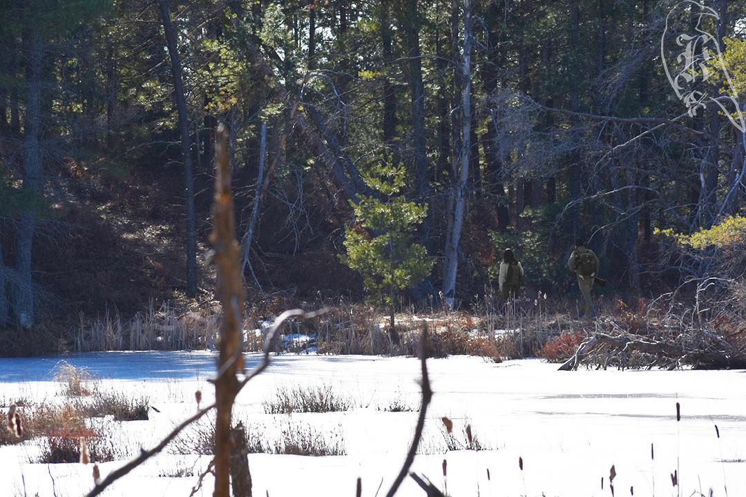
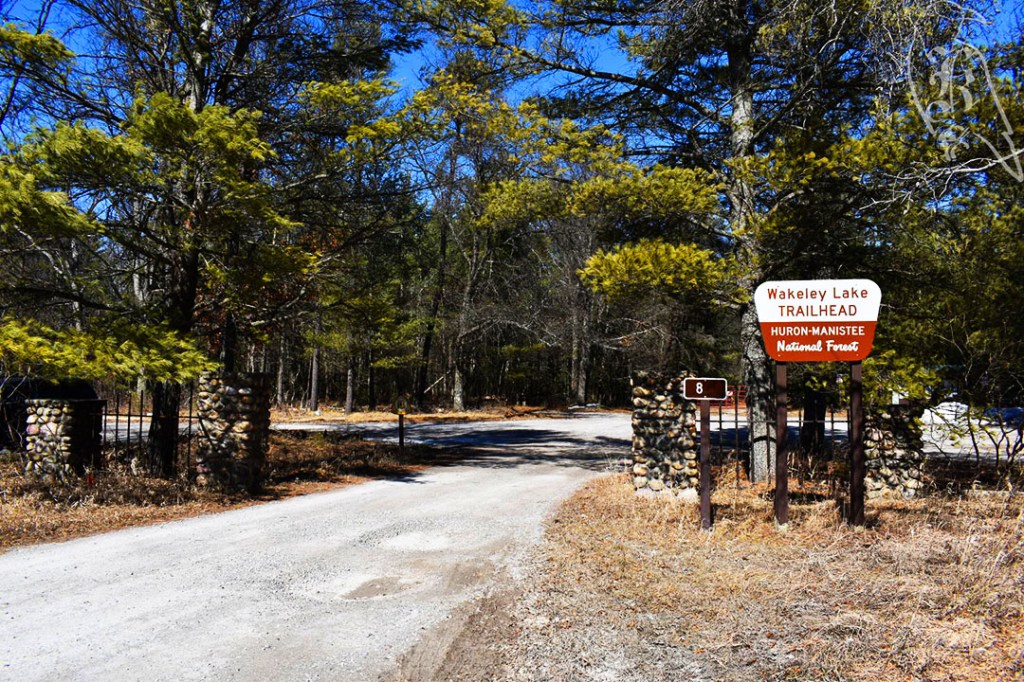
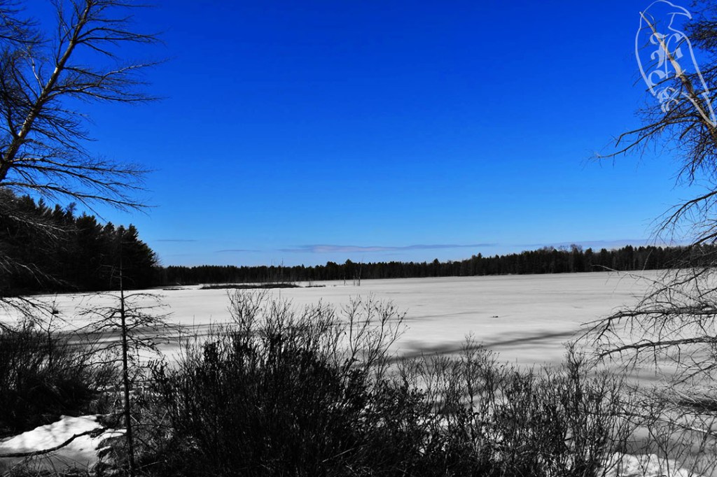
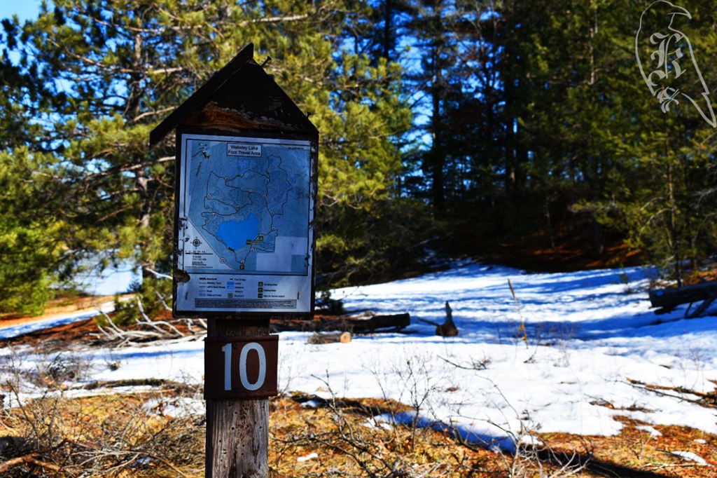
Wakeley Lake
Then, I was off to another 4 miles on Wakeley Lake. This was the first national park I hiked in. I had some issues buying a day pass, but once I got my phone to connect it was great.
I will likely return to do the full 9 miles at some point and take advantage of the camping facilities available there.
The trail was marked as semiprimitive, but it was well marked throughout the majority of the trail (there were a few markers that needed refreshing). It was a little more challenging than Au Sable River, but still relatively easy and led to a brisk approach.
A plan for a 3 mile trek, I ended up going 3.4 and around Springlake instead of sticking to the original trail. It was well marked, but I ended up taking the wrong fork at one point, due to only a quick glance at the map, and by the time I could cut back to where I wanted to be, it was marked as one way. (I still don’t understand the point of one way trails, but I do my best to listen to postings.) This led me on a bit of an adventure and took me to the other side of the lake, which is more trafficked due to the boat launches (not functioning due to the lake still being frozen) and the playgrounds and pavillions.
The terrain was a bit less covered this week, until the very end of the hike. It was much softer ground where there wasn’t ice, so the microspikes weren’t as worn out by the end of the day. Still, if earlier in the week hadn’t convinced me, this one definitely showed I needed less aggressive traction gear. It got me back to a much needed gear up at REI in the earlier part of the next week.
I hit pavement at one point, which I hate in my boots, but it was well cared for until you got into the shade. It still hadn’t really had time to do much thawing, so the final bit of my time was spent precariously on ice trying not to put my spikes back on.
After three weeks away from the trails on family business, I decided to take an extra day off work and conquer two trails at once. This sent me to the Lansing area where I took on The Ledges and then hit the Green Trail out at Lake Lansing Park-North. After a few weeks of rough weather and then warming up, both trails proved to be a different points of unfreezing, which made it difficult to go without crampons but proved that my microspikes were too much. Needing a few items as we gear up for warmer weather, I did grab a pair of Yaktrax the next week after a few mishaps with having gear that was meant for slightly more difficult weather.
The Ledges were the trail that finally got me to download the All Trails app, which, I have to say, I love so far. It is The Ledges, not Ledges Trail, as it is called in the book. That trail is somewhere in Peninsula, Ohio. If you aren’t looking through AllTrails, you’d also need to search for Fitzgerald Park instead of the suggested Fitzgerald County Park. That is the actual name of the park, but didn’t come up when looking through my GPS options.
This is the trail that finally got me to download AllTrails (which I love). It is 2.4 miles with an optional 1.3 mile loop on the other end, with the trailhead and parking in between. If I hadn’t planned to do two trails, I would have checked out the loop as well.
I don’t know why in the world this is considered easy, although I’m sure it’s much more passable when it isn’t covered in snow and ice. I have deemed “easy” trails as ones I would take my mother on, and this definitely isn’t one of them. When they say narrow paths, they mean it.
I went back and forth with my spikes. Down the stairs and through Island Park, I went in just my boots as they were perfectly fine, but I wore my spikes and used my trekking pole for the entirety of the ledge. On the way back, I awkwardly used it in my other hand to feel more steady on the edges.
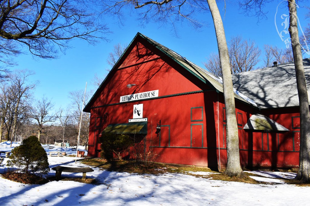
You can also access The Ledges via Island Park, but the entire trail (and the best way to “loop” with the island) starts in Fitzgerald County Park. The Indigenous peoples called this area Big Rock, but it seems that spiritualists took over in the 1890s. Their pavilion was converted into a theater by the Grand Ledge community in the late 1950s and still stands in the park.
Green Trail
This is actually just the Lake Lansing Park North Trail, which is one of several color-coded trails in the area, largely used for skiing in the winter. Although, I saw almost no one. I ended up taking the longer, Blue Trail at 3.5 miles. It is only .2 miles longer than the Green Trail and you actually are on the green portion for the majority of the trek.
This is a one way trail, but I would suggest instead of starting at the trailhead, parking at the end of the trail. When you come to the sign that points you toward the trails, turn right toward “Oak Knoll” instead of left toward the trails. Here, there is a connection back to the trailhead.
As I had done both hikes on spikes, I decided to take them off at this point and walk up the road back to my car instead of the ice that awaited me cutting back up to the trailhead.
This trail was really rough on my legs because it was not consistently frozen. The trail was a myriad of different terrains because of this: frozen solid, unfreezing (leading my boots to go through the ice), muddy, and the soft wood of the bridges. I did not often feel stable on my spikes unless it was on the solid ice. And, the changing terrain led to spike maintenance upon returning home (and planning to purchase less aggressive shoe wear).